Coastal Change from Space
ARGANS Ltd, has developed a global service for monitoring coastal erosion along with climate change impact on the coast, including sea level rise and effect of increasingly dynamic weather systems.
We lead a project commissioned by ESA to assess the end-user benefits from such a service, bringing together professional geomorphological expertise from partners at the British Geological Survey (BGS), the Geological Survey Ireland (GSI), the Environmental Hydaulic Institute Cantabria, the Italian National Institute of Environmental Protection and Research (ISPRA) and Arctus, working with the University of Quebec, Rimouski (UQAR) as part of a Coastal Change consortium.
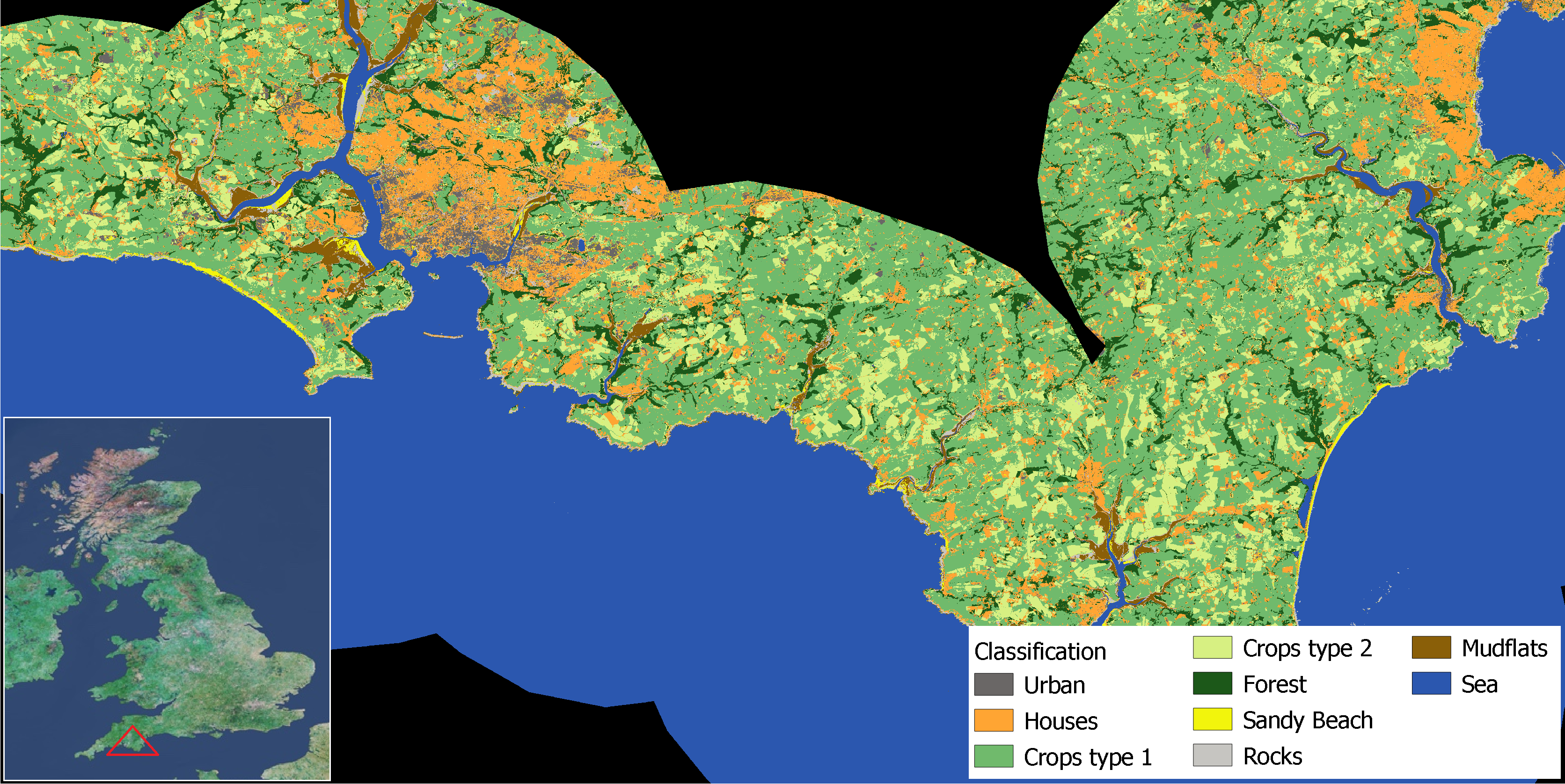
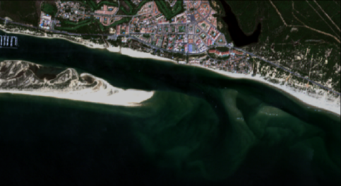
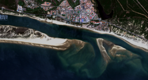
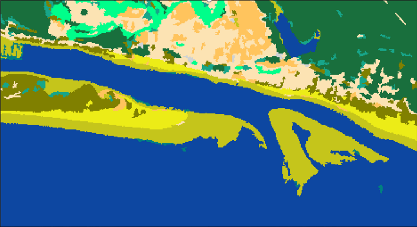
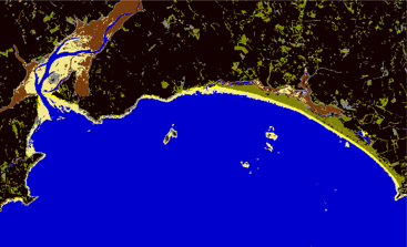
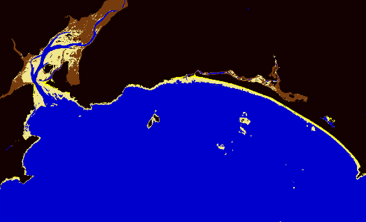
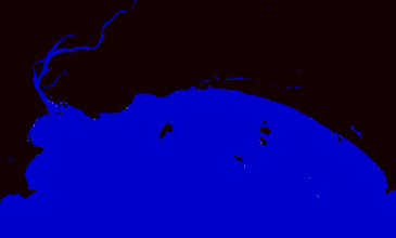
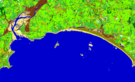
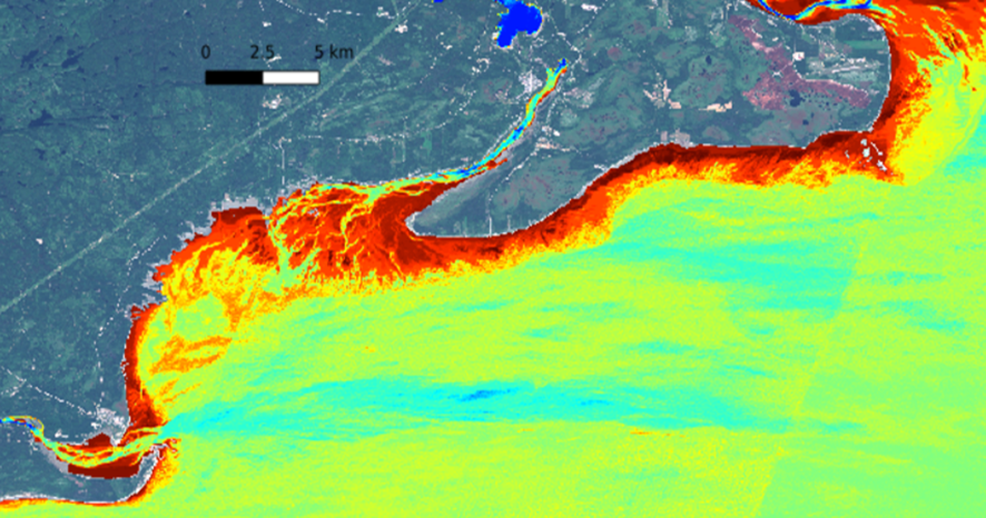
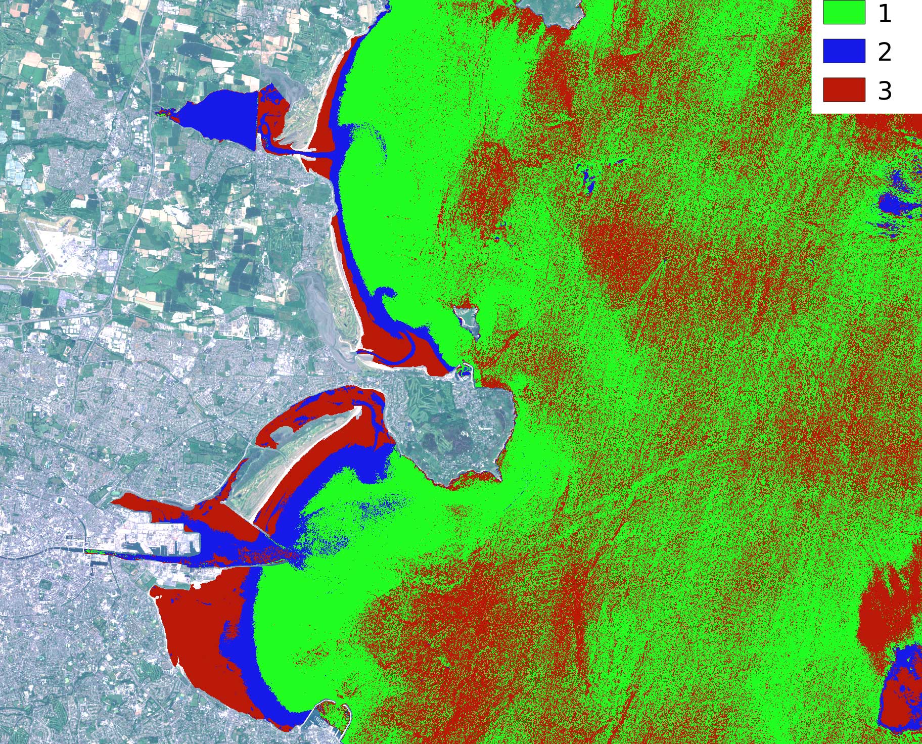
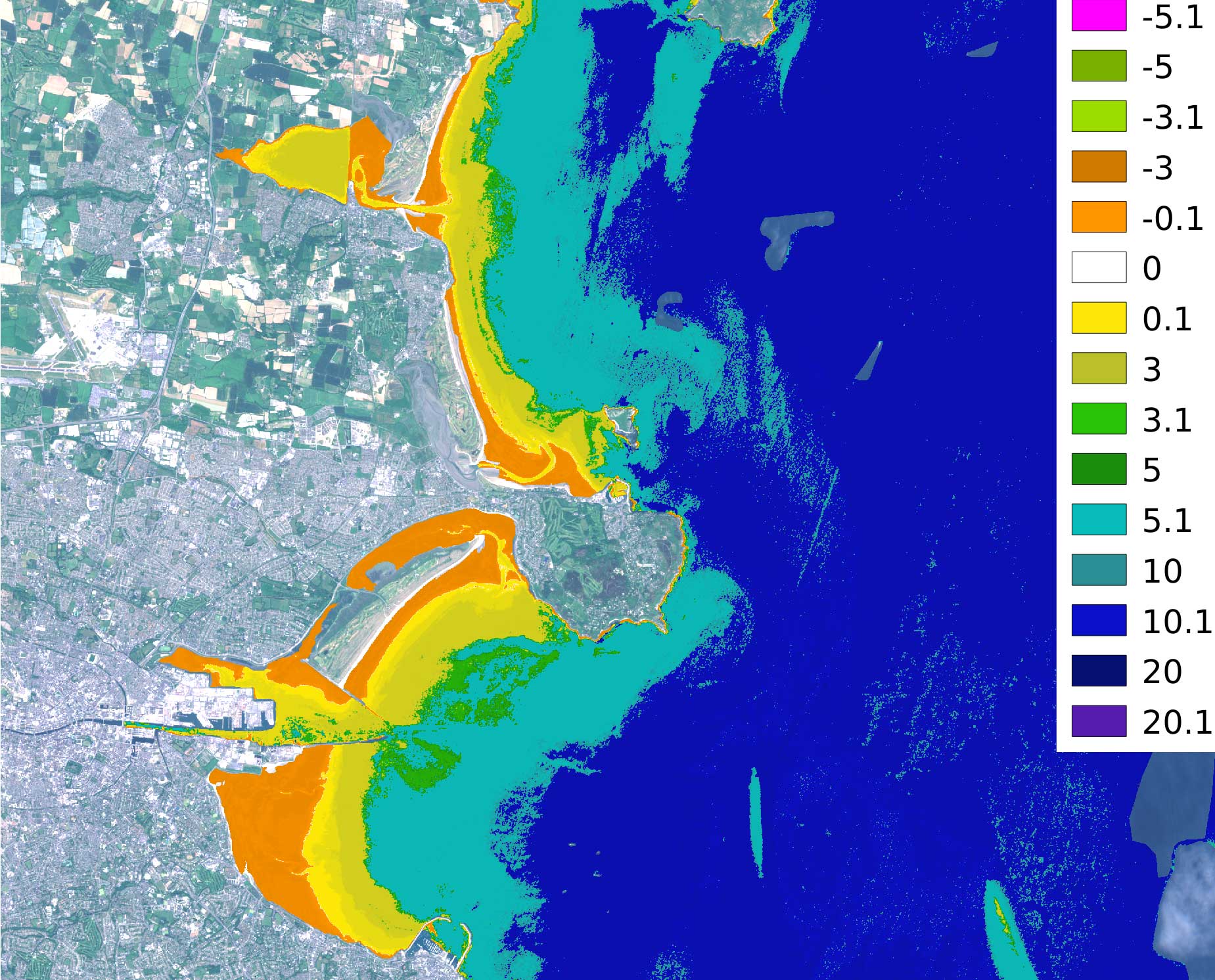
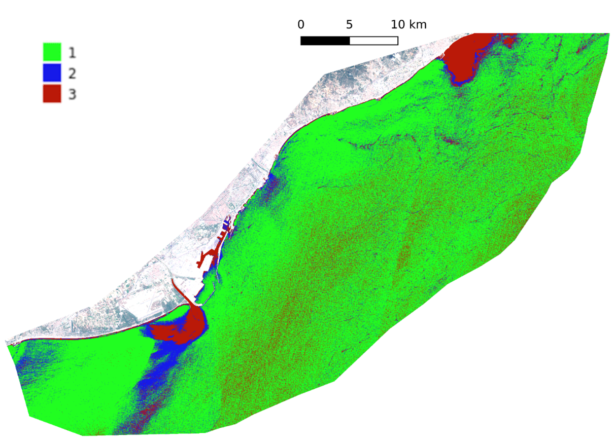
ARGANS Ltd conducted assessments over 25 years using a range of satellite sensors such as Copernicus Sentinel Multispectral and SAR data, USGS Landsat data supported with a blend of some commercial data provided by the ESA Third Party Mission programme.
Monitoring Coastal Erosion by employing a range of innovative Satellite Imagery techniques enables a large spatial scale and a high temporal and spatial resolution to be delivered in an affordable manner which can be made applicable to anywhere around the world.
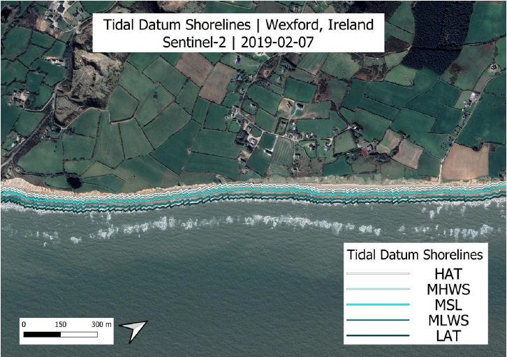
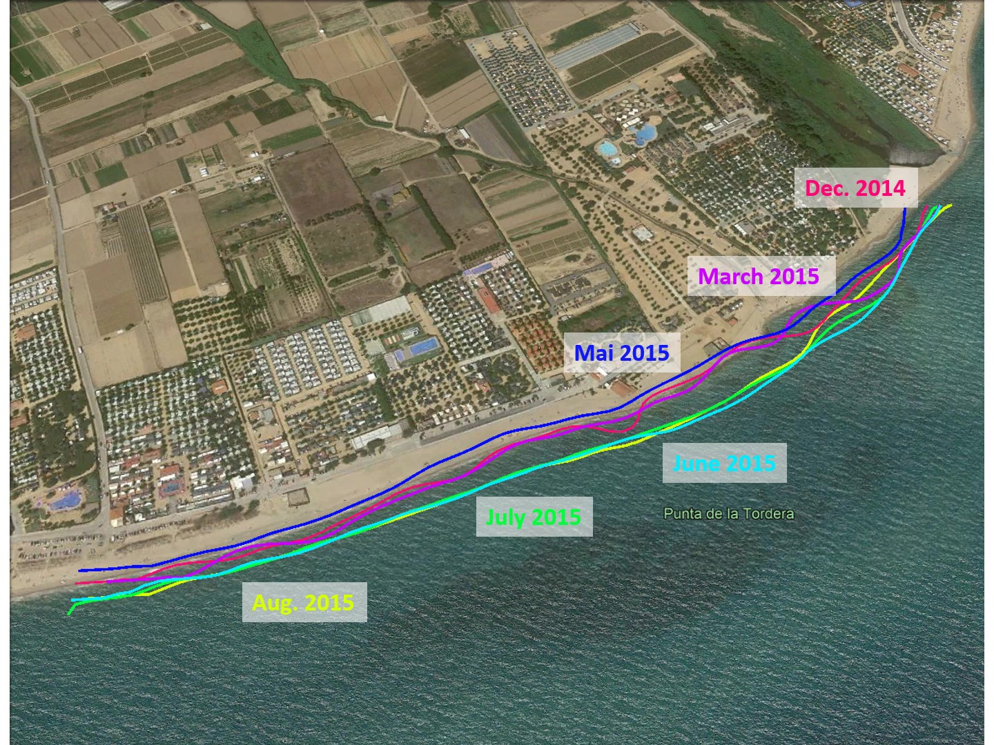
25 year timeseries
Spanning over 25 years of data from Copernicus Sentinel satellites are used to provide specific event as well as long term trends analysis.
Extensive Coastline
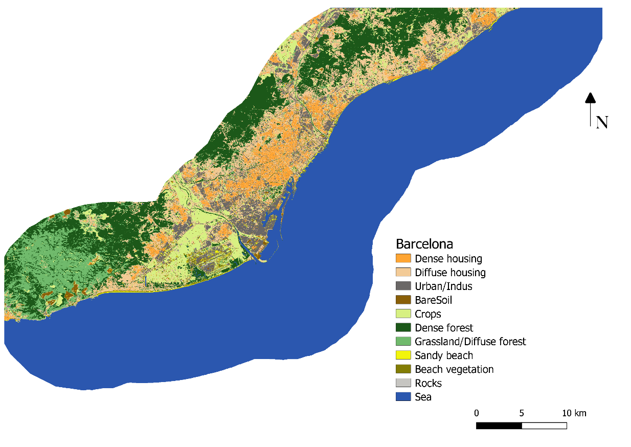
Covering over 7300km of coastline and over 20 study sites in Canada, Ireland, Spain, Italy and UK with a diverse range of geomorphological and environmental conditions.
User Focused
Products developed were driven by the needs of the user community and validated by national geological experts.
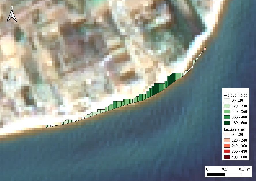
Risk Reduction
Real evidence provided to enable appropriate and cost effective coastal management decisions to be made.